Difference between revisions of "Template:Map locations"
Jump to navigation
Jump to search
m |
(Correcting documentation) |
||
| Line 17: | Line 17: | ||
* You can add up to 15 locations on the map. Every location is controlled by three attributes. | * You can add up to 15 locations on the map. Every location is controlled by three attributes. | ||
** <code>area''n''</code> - Name of a given area/location. | ** <code>area''n''</code> - Name of a given area/location. | ||
| − | ** <code>x''n''</code> and <code>y''n''</code> - X and Y coordinates of the [[:File:Map marker.png|map marker]]. The best way to get those coordinates is to copy an 800px wide version of the image you will be using, then copying the map marker file, adjusting them in the appropiate places, then getting the coordinates of the '''upper | + | ** <code>x''n''</code> and <code>y''n''</code> - X and Y coordinates of the [[:File:Map marker.png|map marker]]. The best way to get those coordinates is to copy an 800px wide version of the image you will be using, then copying the map marker file, adjusting them in the appropiate places, then getting the coordinates of the '''upper left corner''' of the marker. |
* The <code>''n''</code> in the above fields' names is to be replaced with a number from the range (1-15). | * The <code>''n''</code> in the above fields' names is to be replaced with a number from the range (1-15). | ||
Revision as of 17:19, 2 August 2013
| {{{title}}} | |
|---|---|
[[Image:{{{image}}}|800px|link=]]
| |
Usage
This template allows you to add markers to an image. When hovering over the marker, the name of the area will appear.
This template's parameters are:
templatename- Name of the template, without the Template: prefix. Enables the shorthand view/discussion/edit menu.collapse- Collapses the box on load. Off by default. Usecollapse = trueto collapse the box.title- Title of the box.image- Filename of the image to be used as the base for the map location template. The image will be automatically resized to be 800 pixels wide.- You can add up to 15 locations on the map. Every location is controlled by three attributes.
arean- Name of a given area/location.xnandyn- X and Y coordinates of the map marker. The best way to get those coordinates is to copy an 800px wide version of the image you will be using, then copying the map marker file, adjusting them in the appropiate places, then getting the coordinates of the upper left corner of the marker.
- The
nin the above fields' names is to be replaced with a number from the range (1-15).
Example
{{Map locations
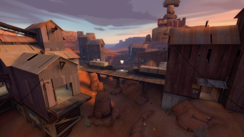
 | title = Badlands - Middle point
 | image = cp_badlands.png
 | area1 = Train
 | x1 = 325px
 | y1 = 173px
 | area2 = Balcony
 | x2 = 204px
 | y2 = 294px
 | area3 = Shithouse
 | x3 = 680px
 | y3 = 286px
 | area4 = Valley
 | x4 = 416px
 | y4 = 277px
 | area5 = Hoodoo
 | x5 = 295px
 | y5 = 213px
}}
will yield
| Badlands - Middle point | |
|---|---|

Train Balcony Shithouse Valley Hoodoo | |